- Wishlist
- Sign Up
- My Cart (0)
Shopping Cart
Your cart is empty
You have no items in your shopping cart.
Continue Shopping
Let's go buy something!
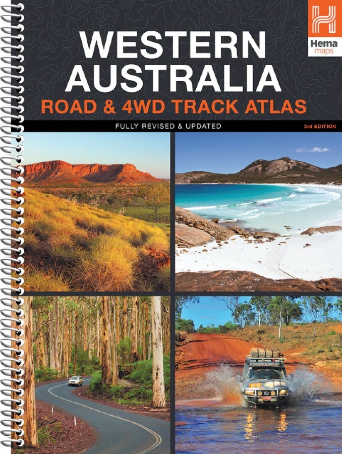

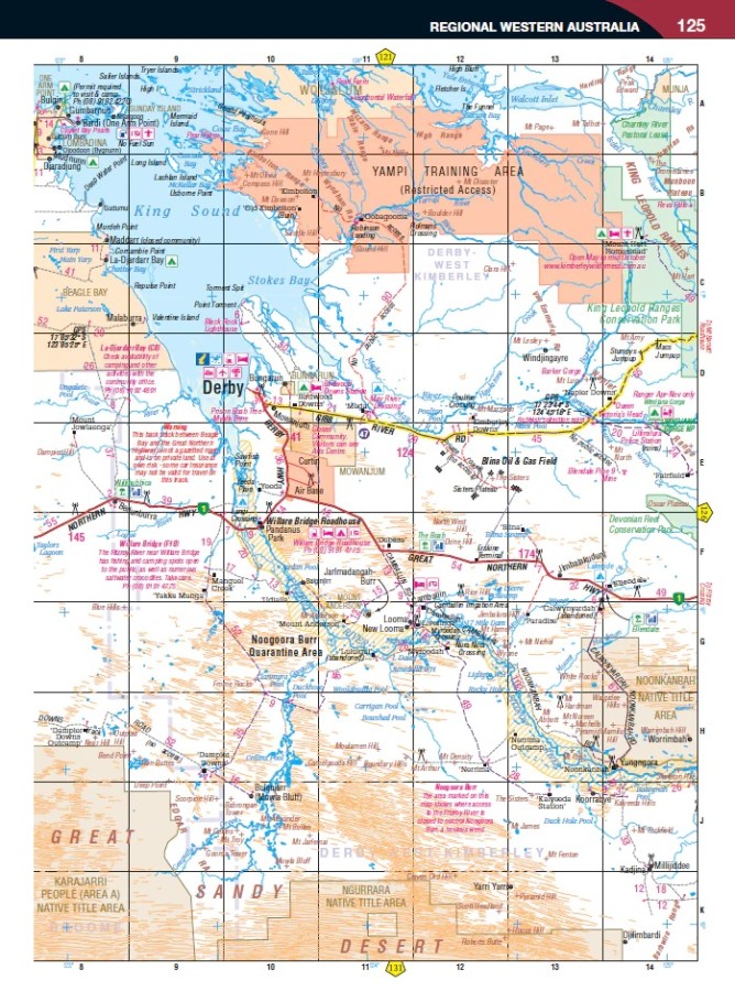
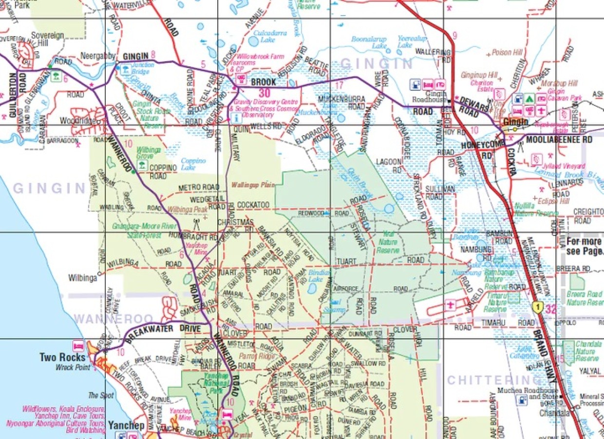
Hema Western Australia Road & 4WD Track Atlas
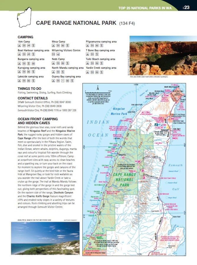
$35.95Discover Australia’s largest state with the Western Australia Road & 4WD Track Atlas. Plan and navigate your trip with state-wide atlas mapping, which includes detailed coverage of Perth and Southwest Western Australia (WA). Find an adventure with a list of the state’s Top 50 4WD Trips, which each have a track grading, distances, contact information, and an atlas reference. There’s even detailed information on Western Australia’s Top 25 National Parks, including camping areas within each park, things to do, contact details, an inset map, and a rundown of what makes each park unique. To top it off, there is also a list of private camping areas and caravan parks, an index, and a list of all accredited visitor centres within Western Australia.
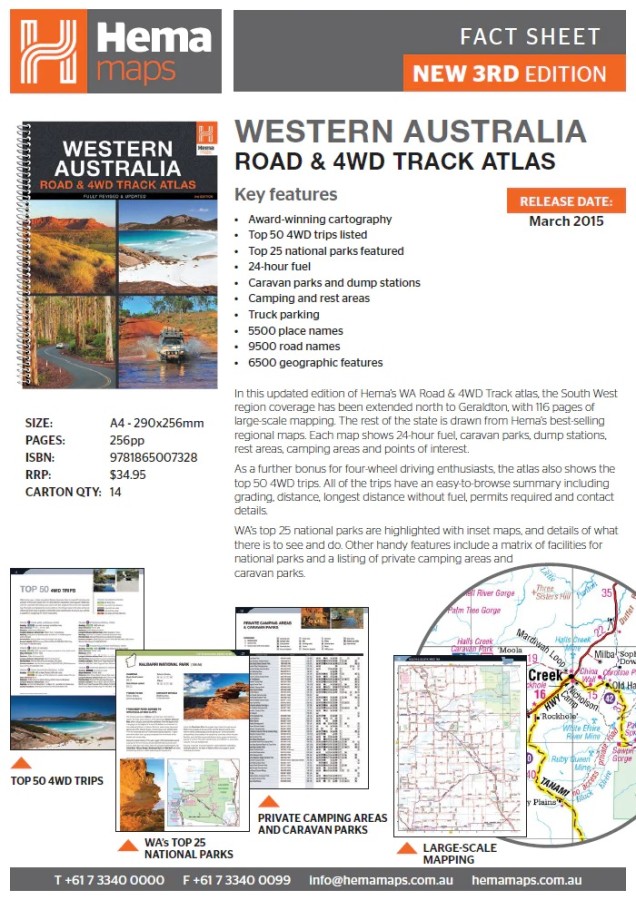
Key Features
Top 50 4WD Trips
Top 25 WA National Parks
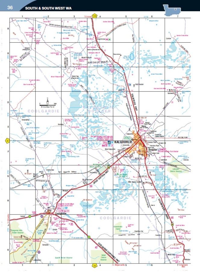
Detailed mapping throughout the State (1:250,000)
Caravan parks & dump points
Camping and rest areas
Truck Parking
Visitor Centres
- Description
Key Specifications
Edition: 3rd
Publication Date: 01/04/15
Number of Pages: 211
Height: 290mm
Width: 230mm
Depth: 20mm
Weight: 0.95kg
Related Products

Blue Mountains Climbing Guide
Books $59.95
The Great North Walk
Books $32.99

Mount Yengo
Books $16.00