- Wishlist
- Sign Up
- My Cart (0)
Shopping Cart
Your cart is empty
You have no items in your shopping cart.
Continue Shopping
Let's go buy something!

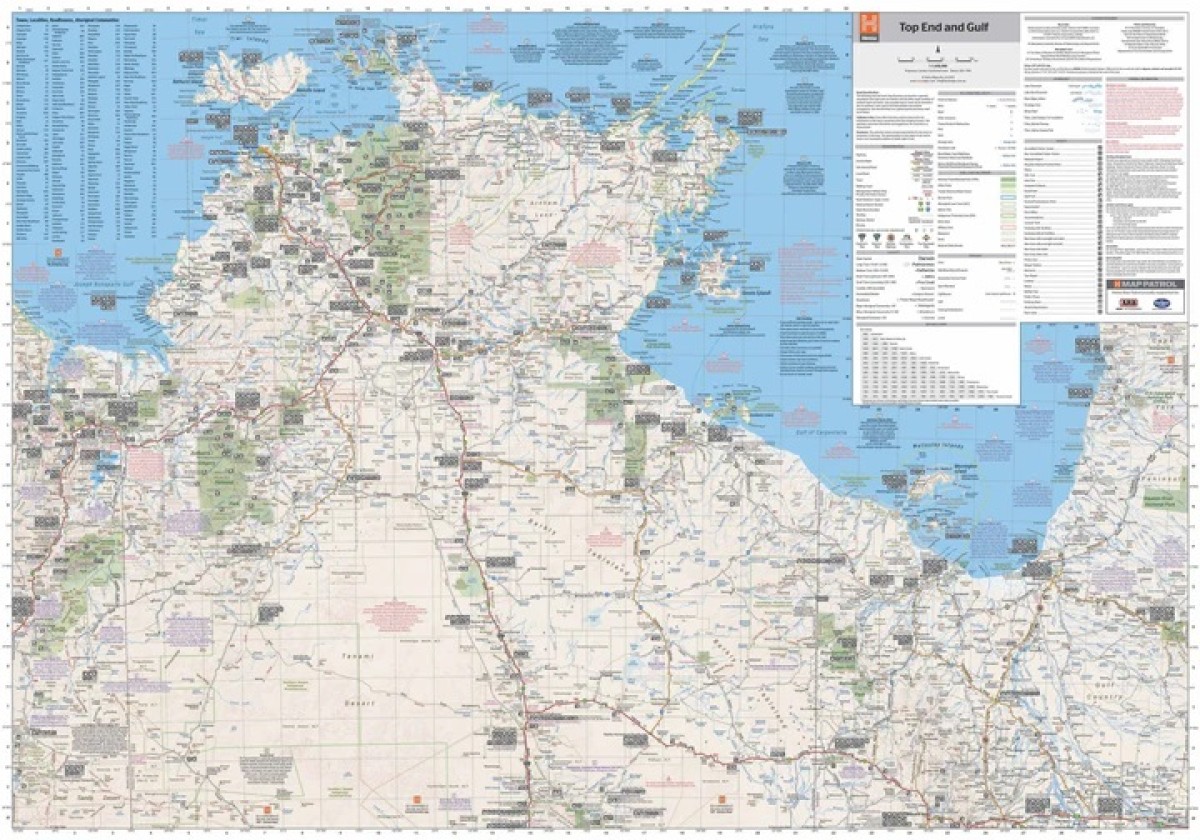
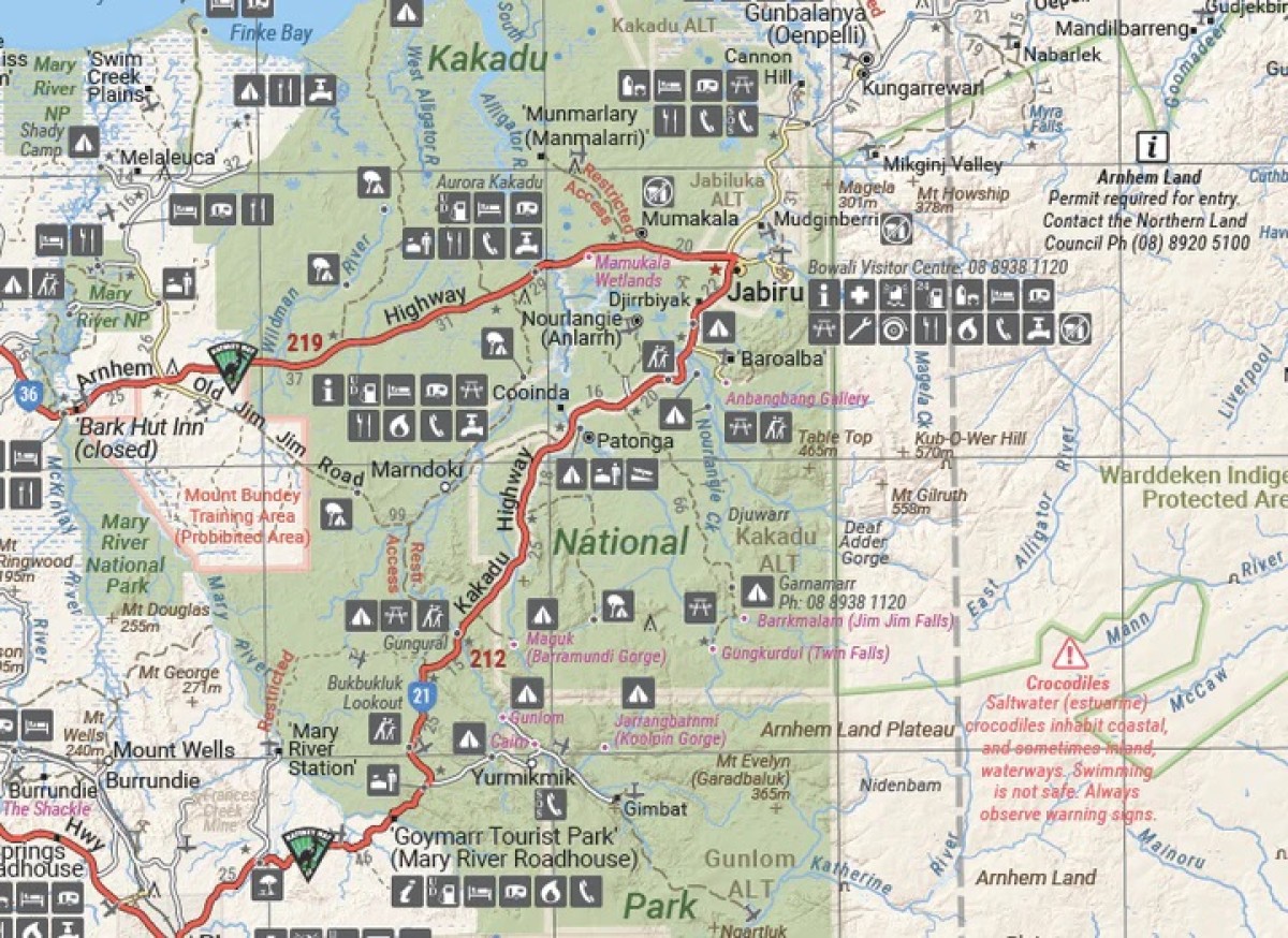
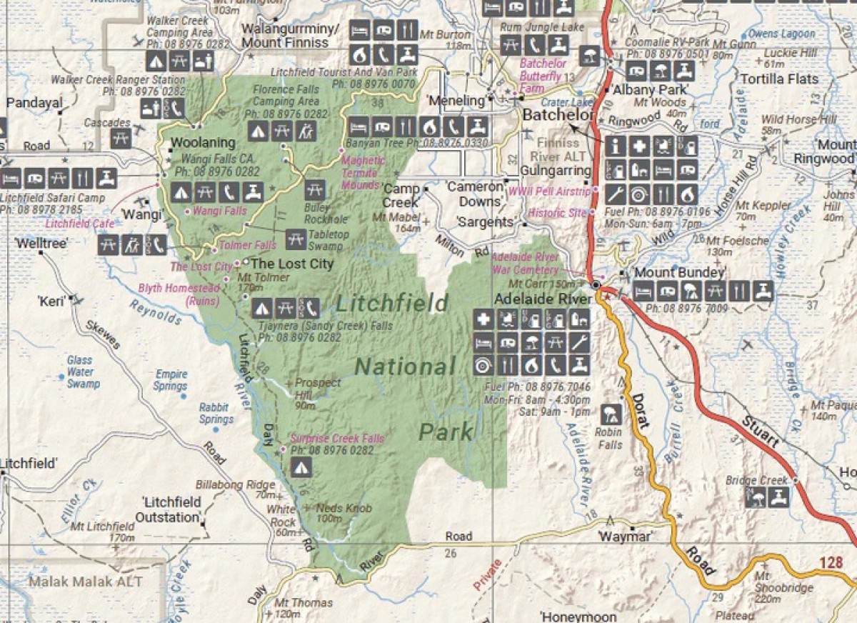
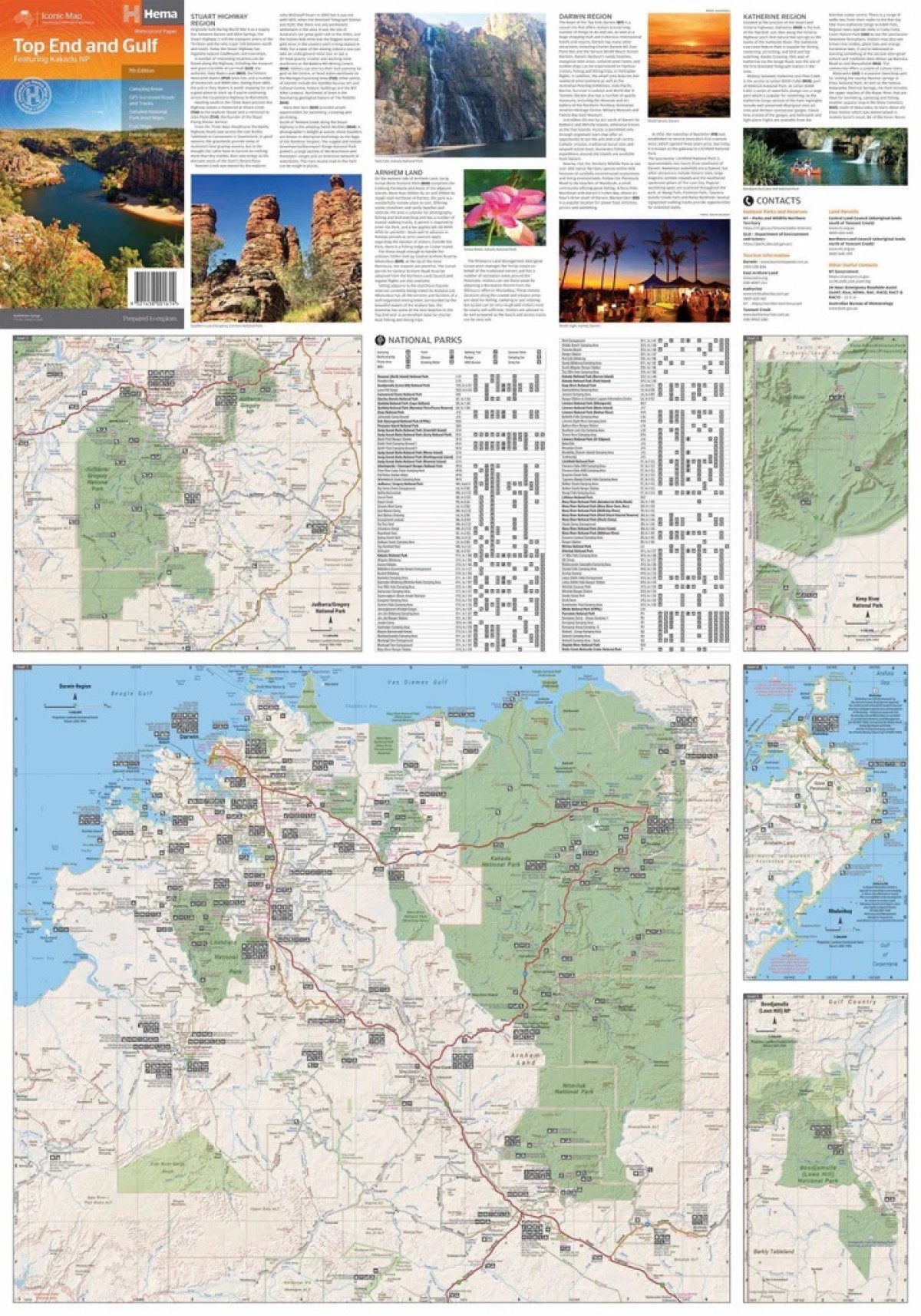
Hema Top End and Gulf Map featuring Kakadu NP
$14.95This regional waterproof map of the Top End and Gulf is ideal for discovering the northern parts of Australia’s NT by 4WD. It includes a main map of the Darwin region, Judbarra / Gregory National Park, Nhulunbuy, Keep River National Park and Boodjamulla (Lawn Hill) National Park.
There is additional tourist information for Arnhem Land, the Roper River trek, Darwin region, Douglas-Daly district, Nature’s Way, Victoria Highway, Katherine Region and the Stuart Highway Region.
Key Features
GPS surveyed roads and tracks
Fuel stops
Self-drive 4WD tracks
Camping areas
Historic sites
Detailed National Park inset maps
Waterproof paper
- Description
Edition: 7th
Publication Date: 01/07/19
Scale: 1:1,650,000
Folded size (WxHxD): 140mm x 250mm x 3mm
Flat size (WxH): 700mm x 1000mm
Weight: 0.09kgs
Related Products

Hallwag France Map
Maps $15.95
Nimmitabel
Maps $16.00
Coolumbooka
Maps $16.00
Davies Plain
Maps $16.00
Wyndham
Maps $16.00