- Wishlist
- Sign Up
- My Cart (0)
Shopping Cart
Your cart is empty
You have no items in your shopping cart.
Continue Shopping
Let's go buy something!


Maps
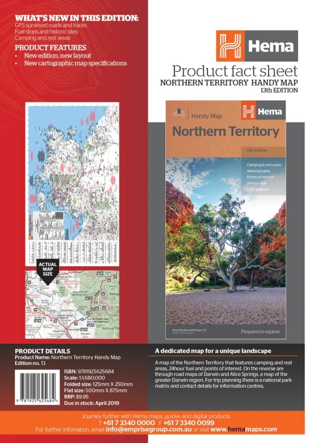
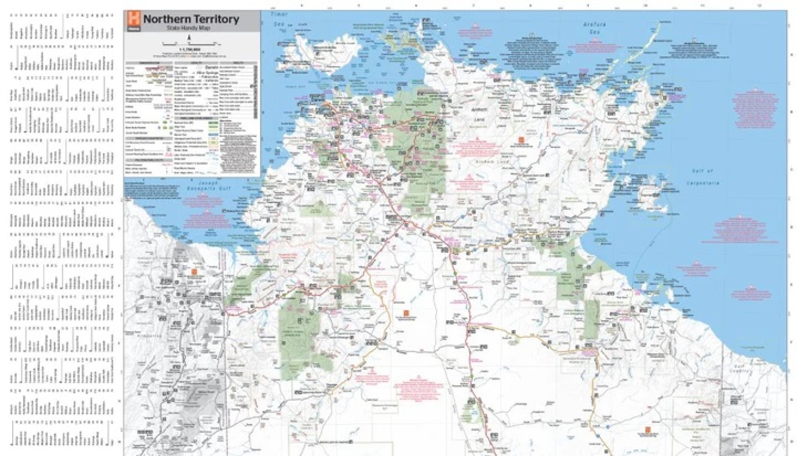
Hema Northern Territory Handy Map
$11.95A map of the Northern Territory that features camping and rest areas, 24hour fuel and points of interest. On the reverse are through road maps of Darwin and Alice Springs, a map of the greater Darwin region. For trip planning there is a national park matrix and contact details for information centres.
Key Features
GPS surveyed roads and tracks
Fuel stops
4WD tracks
Camping areas
Historic sites
Detailed inset maps
Description
- Description
Key Specifications
Edition: 13th
Publication Date: 15/04/19
Scale: 1:1,750,000
Folded size (WxHxD): 125mm X 250mm x 3mm
Flat size (WxH): 500mm X 875mm
Weight: 0.05kg
Related Products
")

Hallwag France Map
Maps $15.95
Gowan
Maps $16.00
Greg Greg
Maps $16.70
