- Wishlist
- Sign Up
- My Cart (0)
Shopping Cart
Your cart is empty
You have no items in your shopping cart.
Continue Shopping
Let's go buy something!

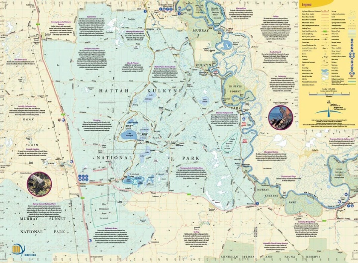
Hattah – Kulkyne Map Guide Meridian
$10.95Topographic map (1:75,000 scale) from Meridian Maps covering the Hattah-Kulkyne National Park and the Murray Kulkune Park with enlargements of Lake Hattah and Lake Mournpall camping areas. Features all the tracks, camping areas and lakes of the park. Ideal bushwalking, cycling and four-wheel drive map for this diverse Mallee park. Includes notes on the parks history, ecosystems and activities.
Key Features
Detailed mapping of Hattah-Kulkyne National Park and the Murray Kulkune Parks
Field and Track Notes
Walking & 4WD Tracks
Suitable for use with GPS
Detailed campground maps
Historical and tourist information.
- Description
Key Specifications
Edition: 2nd
Publication Date: 01/06/10
Scale: 1:75,000
Folded size (WxHxD): 100mm x 250mm x 3mm
Flat size (WxH): 594mm x 420mm
Weight: 0.06kgs
Related Products

Wyndham
Maps $16.00
Davies Plain
Maps $16.00
Hobart To Norfolk Bay
Maps $44.00
Coolumbooka
Maps $16.00